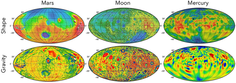
High-level products such as the topographic maps and gravity fields of Mars, the Moon, and Mercury were produced through geodetic analyses. They have had great impact on the science community, enabling advances in many other fields of planetary science. The support of planetary geodesy capabilities at GSFC will continue this expertise to benefit planetary science at NASA and beyond.
Co-Leads: Erwan Mazarico and Michael Barker
NASA Goddard Space Flight Center has an established expertise of high-impact analysis of foundational geodetic datasets, from spacecraft radiometric tracking to laser altimetry. This expertise has primarily been built up through and supported by numerous instruments and missions, and is unique within NASA centers. We strive to ensure that these datasets remain available at GSFC to benefit NASA and the entire planetary science community.